Tom Hunt, MP for Ipswich, is in the local newspaper again looking for another access to the Ravenswood estate to try and solve the congestion problems in the area.1. Creating a new access to the estate will simply generate yet more motor traffic and congestion in the long term thanks to induced demand. There will… Continue reading Alternative traffic improvements around Ravenswood, Ipswich
Category: Cycling
Ipswich Parks Byelaws Consultation Update
Further to my previous blog post about the cycling in parks as part of the consultation on changing the Ipswich Borough Council’s Byelaws, the response to that consultation and the next steps are going to the next Executive Council meeting on Tuesday 11th January 2022. It’s item 8 on the agenda. The written responses to… Continue reading Ipswich Parks Byelaws Consultation Update
Cycle friendliness of Bramford Lane roadworks
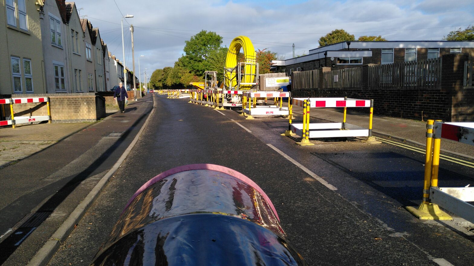
Bramford Lane in Ipswich is currently part closed for gas main works. Bramford Lane is a residential road in and out of west Ipswich in-between 2 main roads. It is signed as a local cycle route, and part of it is on national cycle route 51 (just off the part that is closed). There are… Continue reading Cycle friendliness of Bramford Lane roadworks
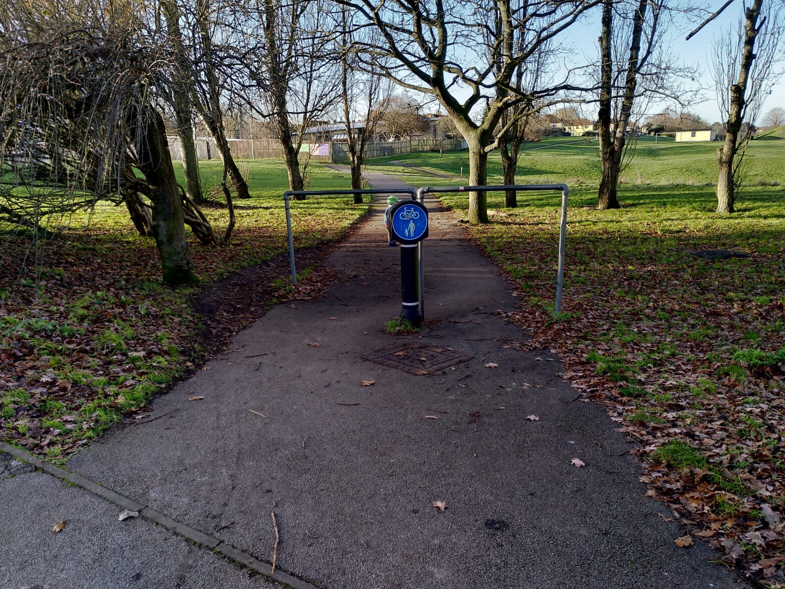
Ipswich Park Byelaw change consultation
Ipswich Borough Council are consulting on the current by-law changes to bring them up to date having not been changed for a few decades. They have a short consultation with 3 questions, here’s my answers to the questions. 1. Do you agree with the proposed new byelaws? My answer: No 2. Are there any additional byelaws… Continue reading Ipswich Park Byelaw change consultation
Suffolk Looking to make Transport Carbon Neutral
Suffolk Council Council as part of Transport East, who represent Suffolk, Norfolk, and Essex highways and transport authorities, are looking to reduce the carbon emissions of transport in the region. Here’s some of my ideas of what could be done to reduce the carbon emissions in the region. Local The majority of journeys people make… Continue reading Suffolk Looking to make Transport Carbon Neutral
Is it time for a quieter neighbourhood between Bramford Road and Norwich Road in Ipswich?
Suffolk County Council are making many changes to increase active travel to prevent a significant proportion of people switching to driving a private car and causing gridlock and additional pollution after the lovely low air pollution and traffic levels during the lockdown. One of the proposed changes is to make Bramford Lane a little more… Continue reading Is it time for a quieter neighbourhood between Bramford Road and Norwich Road in Ipswich?
5 minutes and 4 crossing to cross the main road outside Royal Infirmary Edinburgh
Last month I was up in Edinburgh visiting family. Whilst on a wander I came across a crazy long crossing over the main road outside the Royal Infirmary Edinburgh. The 4 crossings took just under 5 minutes to cross with a button press at each crossing. I used the most direct crossing possible, following the… Continue reading 5 minutes and 4 crossing to cross the main road outside Royal Infirmary Edinburgh
The horror of “cyclists dismount and use footway” signs at roadworks
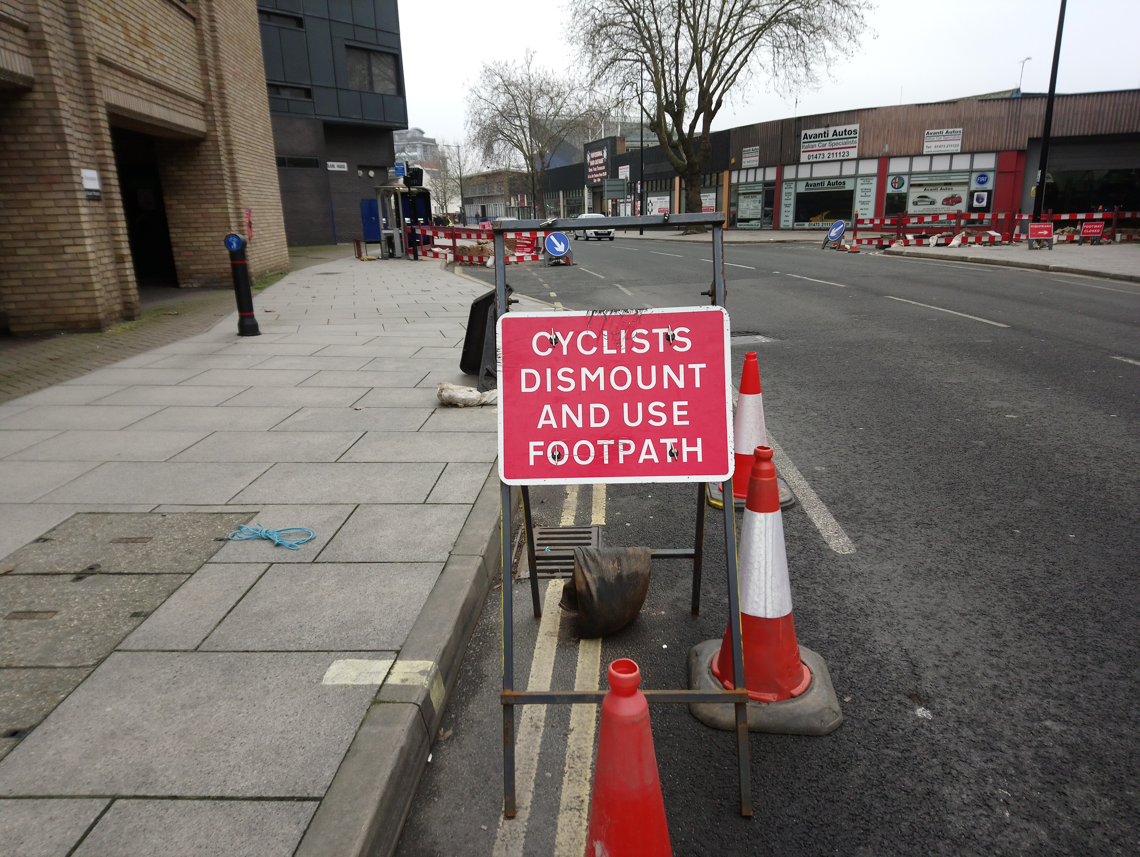
On the 13th January 2018 walking with my family from Ipswich town centre to the railway station I came across some roadworks on Princes Street including some dangerous signage around some roadworks First was the “cyclists dismount and use footpath” sign: I very much dislike the use of this sign for a number of reasons.… Continue reading The horror of “cyclists dismount and use footway” signs at roadworks
An unexpected filtered permeability trial in Ipswich
On 12th May 2017 a sinkhole appeared in the street that I work on in Ipswich. The road was closed to motor vehicles for a few weeks until the repairs were completed. After the initial period while people got used to the road being closed, I noticed a significant change in the traffic patterns in… Continue reading An unexpected filtered permeability trial in Ipswich
The dilemma of highway rules vs friendly drivers
I’m currently teaching my 1½ year old daughter how to cross the road on various trips out, including the 5 minute walk along the road to or from our childminder. She is very good at staying on the pavement, and when it come to crossing the road will wait and look for vehicles that are… Continue reading The dilemma of highway rules vs friendly drivers