Last weekend (22-25 August) I went over to Dublin for the Dragheda Mapping Party. I took the train and ferry over, instead of flying, so that I could take my bike. I did get some coding and catching up done on the train and ferry. I found it interesting that Virgin Trains run electric to Crewe, then attach a diesel locomotive on the front to continue into Holyhead. I also found that Virgin Trains now have “enhanced mobile reception” on their trains. I did have to give up trying to use the GPS as Virgins don’t have enhanced gps reception.
I was staying in Dublin and travelling up to Dragheda each day. There has been some considerable progress in the area over the weekend, going from only the main roads mapped to most of the town being mapped by the end of the weekend.
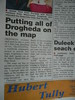
There was some pre-event publicity in a local paper. However the original press release that went out somehow got completely mis-interpreted.
On the Saturday there was a lot of overlap between the mappers, so we got all the traces and photos loaded on to Dermot McNally’s Mac, and done the editing all at once. It prevented people adding the same roads multiple times.
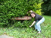 On the Sunday morning I was picked up by Dermot and we done some car mapping on the way to the venue. At one point we had to get out and hold the vegetation back so that we could take a picture of the street sign.
On the way back I hit the start of the 17 day closure of the west coast mainline for rail works, so had to change trains and get lost going from Birmingham New Street to Birmingham Moor Street. I did manage to get a trace all the way back, and map a few streets in Holyhead. Probably should have stayed in Holyhead to do some more mapping and take a later train.