On Saturday I cycled from London to Brighton. It’s the first day long cycle that I’ve done since I cycled from Bletchley to Bedford and back, over a month ago. Yeah I did lots of cycling at the Woking Mapping party, but there was lots of breaks and cul-de-sacs.
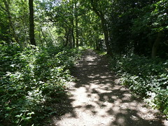
I couldn’t even get 10 minutes away, and I managed to get totally confused by the signage for the National Cycle Network route 23. Having the Cycle Map and an intermittently working bluetooth GPS was really useful. Looking at the trace and where the sign posts were it appears that some of the signposts around the South end of South Norwood Country Park are totally ambiguous, alternatively the route has been changed recently. There was a few other places that I had to double back because I had missed a turn.
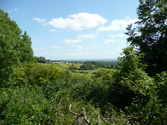
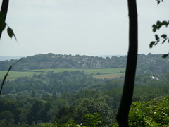
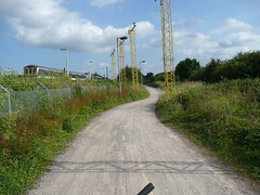
Further south there was some nice views across the hills.
I was quite surprised when I found that the national cycle route goes right through the middle of Gatwick airport.
Had a little bit of a wander in Brighton before getting the train home.
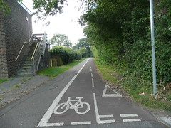
I added a few extra pois, road names and the southern end of the ncn 20 into Brighton to the osm data.
In the future I should try and leave before lunchtime, for these day long cycles, which I should do more often.
And finally Brighton Peir for the first time: 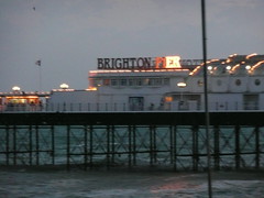
Sounds like you had fun. I forgot to mention that JR and I made the 33 miles from Edinburgh to the Falkirk Wheel. It was an awesome walk, particularly after Linlithgow. The views were stunning! I have to say that the bit around Broxbourne where the canal winds back on its self several times was a bit annoying though.
Sure did enjoy it. The Union canal was specifically built to avoid the hills, hence it bending back on itself at Broxburn.
Nice. Agreed on the NCN maps, just a bloody nightmare, in May I did London to Brighton using it, turned into a nightmare after Redhill and Crawley (a shit hole as well) I took the route from the end of the TFL cycle map to Redhill which was where I was due to pick up the National Cycle Route 21 down to Brighton. Got lost there for an hour. In Crawley again I got lost by the split of NCR 21 and 20 – despite the map. What should have been 50 miles, ended up being 65 miles because of the lame markings. Sustrans: not recommeneded, ever.
http://blog.myspace.com/index.cfm?fuseaction=blog.view&friendID=7454256&blogID=399325362&Mytoken=20C7025B-6851-46F2-A0EB1F0B7A67D111141854118
Nice. Agreed on the NCN maps, just a bloody nightmare. In May I did London to Brighton using it, turned into a nightmare after Redhill and Crawley (a shit hole as well).
I took the route from the end of the TFL cycle map to Redhill which was where I was due to pick up the National Cycle Route 21 down to Brighton. Got lost there for an hour. In Crawley again I got lost by the split of NCR 21 and 20 – despite the map. What should have been 50 miles, ended up being 65 miles because of the lame markings. Sustrans: not recommendeed, ever.
My blog on it:
http://blog.myspace.com/index.cfm?fuseaction=blog.view&friendID=7454256&blogID=399325362&Mytoken=20C7025B-6851-46F2-A0EB1F0B7A67D111141854118