Further to my previous post about my bike. I had problems getting a proper chainring from half the bike shops in Edinburgh, so instead I got a second hand bike that was similar to my old one.
Just over a year ago, I cycled from Edinburgh to Berwick-Upon-Tweed. Since then I have been trying to do it in both directions. However the past occasions that I tried to do it something came up. On Saturday I left home for a rather long cycle. Before I left I loaded TrekBuddy with a map of South East Scotland so that I had some idea of where I was.
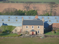
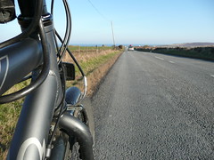
The overall cycle was tough. First I headed out East from Edinburgh through Musselburgh on to the A199, out to Dunbar. Parts of the A199 have some nice cycle lanes. As the road is fairly flat and straight you can easily get the speed up to do a nice sprint. This was the easy part of the route, as I have done it before.
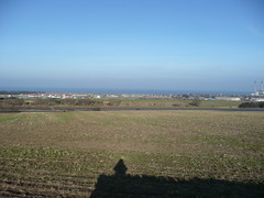
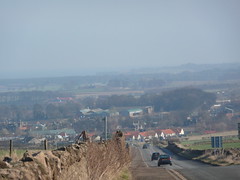
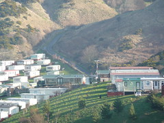
At Dunbar I started to head south towards Berwick-Upon-Tweed. Parts of this part of the A1 can be scary, however it the only way south close to the coast that I know of. In the middle of the Borders, I decided to head through Pease Bay again. It is a steep road down to the bay, where the caravan park is, however it is even steeper on the other side heading out of the bay.
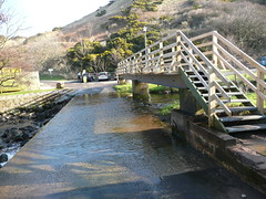
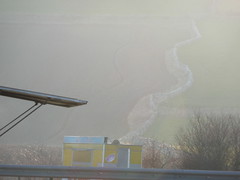
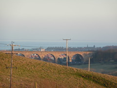
As I had the map in TrekBuddy, I was able to find the A1107, which joins the A1 with Eyemouth in a loop. This helped me to stay off the A1 for a lot longer than I did the last time. It was a nice road into Eyemouth, with some great views of the North Sea. From Eyemouth I headed along the “Berwickshire Coastal Route”, which meant that I was on the A1 for even less, and I’d have even more data to be able to add to OpenStreetMap.org.
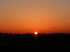
At the border between Scotland and England, I took a snack and photo break.
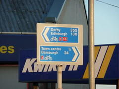
From the Border, it is only a few miles more into Berwick, where I joined the National Cycle Network Route 1 to head back to Edinburgh.
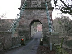
The National Cycle Network takes you on the quietest roads possible. This will usually mean that they are quite hilly, longer and going into the middle of nowhere. There were some points where you could just see fields or trees, but no lights apart from my own bike or the occasional car. As you are heading west along the National Cycle Network, it does zig zag between Scotland and England a few times. At one point there is a bridge that was built in 1820, and still in use today.
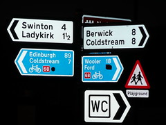
In Norham there was a sign that was rather confusing, as it had the wrong National Cycle Network Route number. Just as well I used the name of the city I wanted to head towards, rather than the route number.
Just before Galashiels, I stopped to check the GPS and found that the phone no longer seen it. Unfortunately the battery in the bluetooth GPS that I’m currently using only lasts for about 12 hours according to the manufacturer. It lasted about half an hour longer, than the manufacturer’s stated operating time, so should I be happy that I couldn’t get the last bit of the trip? The cold weather didn’t help either, as batteries tend to have a shorter life when they are cold.
From there on, there was no point in me taking any more pictures as I wouldn’t be able to Geotag them. Also it was dark so it was difficult to take any decent pictures. Finally stopping to take pictures does slow my average speed down considerably, and I was wanting to get home rather than be on the bike for a whole 24 hours.
From Galashiels I just hit the A7 north to Edinburgh. I did notice on the way that the signs appeared to change from green to white like a yo-yo. Is it a trunk road or a primary road?
Total Distance was about 150 miles in 17 and three quarter hours. Next up on the longer distance cycling is to head round the Forth again.
Now I just need to get the tracks from yesterday added to OSM (amongst the numerous other things I need to do).
2 comments