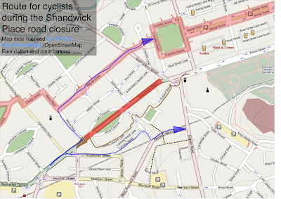
For the next five months Shandwick Place in the west of the centre of Edinburgh is closed for work to move the utilities for when the trams are going to be introduced in a few years time.
The council, TIE and Lothian Buses were quick enough to produce alternative routes for cars and buses, however their alternative route wasn’t suitable for cyclists.
On Friday they provided some written instructions without any maps, which they had done for the car drivers and bus routes.
See below for a map with the council’s route drawn on top of Andy Allan’s rendering of the OpenStreetMap cycle data.
